Fast Facts about the River
The St. Croix Riverway has a watershed of almost 8,000 square miles, which is roughly the same size as the country of Wales. It contains all 160 miles of the Riverway stretching from Solon Springs, WI to Prescott, WI. The watershed includes the Kinnickinnic River, the Namekagon River, Trego Lake, and many other rivers, creeks, and streams. The St. Croix watershed also passes through five different ecological terrains: the Northwest Lowlands, the North Central Forests, the Northwest sands, the Farm Forest Transition, and ends in the Western Prairie Landscape. To learn more, visit: http://dnr.wi.gov/water/basin/stcroix/.
Ways to Protect the River
The St. Croix River Association is dedicated to preventing the spread of aquatic invasive species as we protect, restore and celebrate the St. Croix River and its watershed.
Learn more about our programs and ways you can get involved by visiting our website at stcroixriverassociation.org.
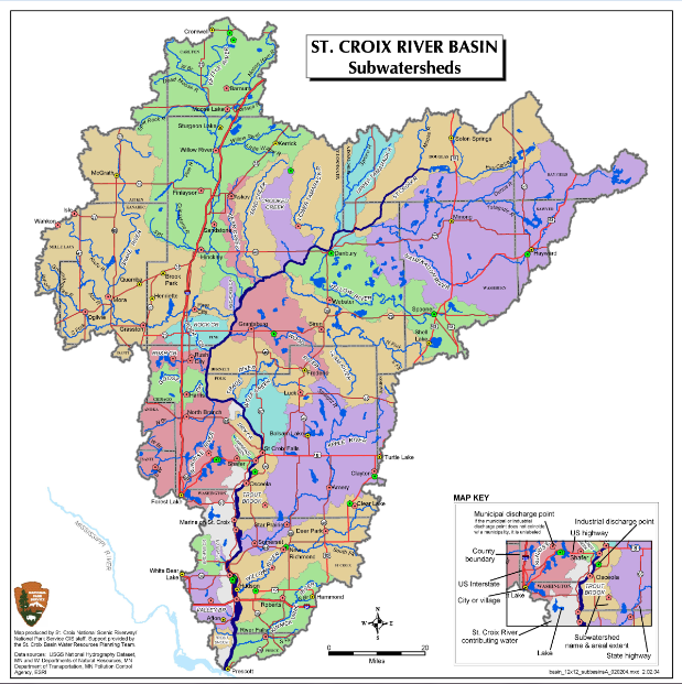
St. Croix River basin
Description
About the basin
The St. Croix basin is a special area of the state. Its abundant streams, lakes and wetlands, rich forests and farmlands, wildlife and fisheries make this a popular recreational destination and location for living. The River begins in Upper St. Croix and Namekagon Lake and drains through diverse ecological landscapes. Starting with the northwest lowlands and north central forests and moving through the northwest sands and farm forest transition, the basin ends in the Western Prairie Ecological Landscape.
These five ecological landscapes present different management challenges and opportunities. Loss of large industrial forest block ownership in the north is a major concern, as are changes in agricultural practices in the western prairie and farm-forest transition landscapes. Agricultural changes include more row crops and a switch from small dairy farming to large confined animal feeding operations which enhance concerns over barnyard runoff, streambank erosion and manure management. Also, St. Croix and Polk Counties face problems associated with rapid growth and development stemming from the St. Paul-Minneapolis Metropolitan Area and struggle to maintain the area’s rural and agricultural features.
Basin resources
The basin is rich in water: groundwater, rivers, streams, lakes and wetlands. Our lakes and rivers are under tremendous development pressure and this will likely increase as the human population continues to grow and settle in this area. Development along lakeshores is one of the state’s fastest types of developments and the basin is no exception. Home building is also occurring along rivers and streams in part due to the dwindling supply of available lakes. Increasing runoff and habitat loss from development degrades water and eliminates or divides contiguous habitat needed by fish and wildlife.
See the Surface Water Data Viewer to view details about the basin.
