Learn how to check the NOAA St. Croix Water Levels online!
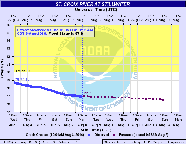
NOAA (National Oceanic and Atmospheric Administration) is the Advanced Hydrologic Prediction Service we use to check the water levels on the St. Croix River. NOAA is courtesy of the National Weather Service.
Any time you need to check the water levels for the St. Croix River (or any other area), you can take a look at the NOAA site. If you click the “River Alert” link at the bottom of any page of our Bayport Marina website!
The NOAA website will show you the water levels at your selected location, “River forecasts for this location take into account past precipitation and the precipitation amounts expected approximately 24 hours into the future from the forecast issuance time”.
If water levels are below 83′ on the chart on the St. Croix River, then you are free to boat as you please (unless in a restricted or “No Wake” zone. However, if the water levels are above 83′ – then a “No Wake” restriction goes into effect on the river.
NOTE: Forecasts for the St. Croix River at Stillwater are issued routinely during the navigation season, and as needed at other times of the year.